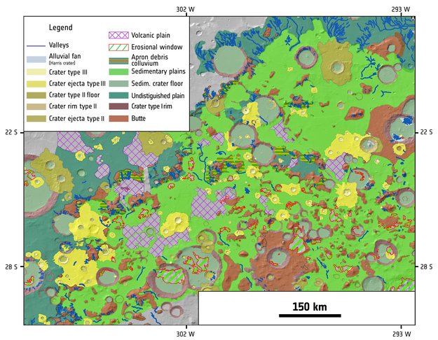
Geological map of region north of Hellas Basin
Date: 05 December 2016
Copyright: from Salese et al., 2016. J. Geophys. Res. Planets, 121, doi:10.1002/2016JE005039, Reused with permission of the American Geophysical Union.
This detailed geological map of the intercrater plains north of the Hellas basin was produced by Francesco Salese and colleagues using images from the Mars Express High-Resolution Stereo Camera (HRSC), the Mars Reconnaissance Orbiter (MRO) High Resolution Imaging Science Experiment (HiRISE), and Context (CTX) camera.
The data from Mars Express and MRO allowed the scientists to explore the region’s appearance, topography, morphology, mineralogy, and age. More specifically, Mars Express imaging data allowed them to study the plains’ geology on a regional scale, providing context for the local-scale observations from MRO.
Analysis of the map provides new evidence for a warm young Mars that hosted water across a geologically long timescale, rather than in short episodic bursts – something that has important consequences for habitability and the possibility of past life on the planet.
Full details of the map and its interpretation can be found in: Salese et al., 2016. J. Geophys. Res. Planets, 121, doi:10.1002/2016JE005039