Louros Valles, south of Ius Chasma

Date: 08 April 2004
Satellite: Mars Express
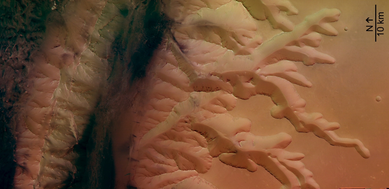
Depicts: Louros Valles
Copyright: ESA/DLR/FU Berlin, CC BY-SA IGO 3.0
The image shows a system sapping channels, called Louros Valles (named in 1982 after river in Greece), south of the Ius Chasma canyon which runs west to east. The Ius Chasma belongs to the giant Valles Marineris canyon system. The Geryon Montes, visible at the northern images border, is a mountain range which divide the Ius Chasma into two parallel trenches. The dark deposits at the bottom of the Ius Chasma are possibly related to water and wind erosion.
'Sapping' is erosion by water that emerges from the ground as a spring or seeps from between layers of rock in a wall of a cliff, crater or other type of depression. The channel forms from water and debris running down the slope from the seepage area. This is known from similar features on Earth, but on Mars it is thought that most of the water had probably either evaporated or frozen by the time it reached the bottom of the slope.
This work is licensed under a Creative Commons Attribution-ShareAlike 3.0 IGO License. 