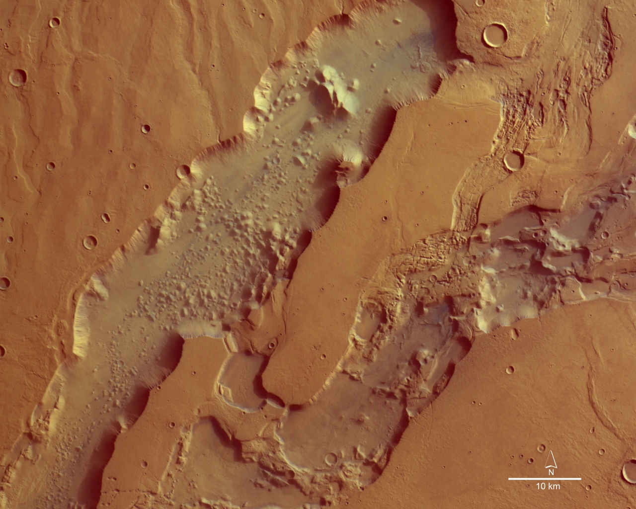
The eroded valleys of Dao and Niger Valles

Date: 16 August 2004
Satellite: Mars Express
Copyright: ESA/DLR/FU Berlin, CC BY-SA IGO 3.0
This image, taken by the High Resolution Stereo Camera (HRSC) on board ESA's Mars Express spacecraft, shows the Dao Valles and Niger Valles, a system of outflow channels on Mars. The image was taken during orbit 528 in June 2004, and shows the Dao Valles and Niger Valles areas at a point where the north-eastern Hellas impact crater basin and the Hesperia Planum volcanic region meet.
The image is centred at Mars longitude 93° East and latitude 32° South. The image resolution is 40 metres per pixel. The image has been created from the HRSC's nadir (vertical view) and three colour channels.
The outflow channel system is, in some areas, 40 kilometres wide. The north-eastern ends of the two valleys are almost 200 metres deeper than the south-western regions which are also shown here. The northern Dao Valles, 2400 metres deep, is about 1000 metres deeper than the more southern Niger Valles. The structure of the valley floor of the Niger Valles is characterised by terraced basins and chaotic fractures. The floor of the Dao Valles is much smoother, but covered with strongly eroded remnants. These eroded valleys are in a region which is part of the southern flank of the Hadriaca Patera volcano. The surrounding surface is formed by lava streams, probably in a 'runoff' process.
This work is licensed under a Creative Commons Attribution-ShareAlike 3.0 IGO License. 