HRSC High-level Data Products Available
6 February 2008
Tuesday, 5 February, saw the release of the first set of high-resolution Digital Terrain Models (DTM) and ortho-images of Mars in the Planetary Science Archive derived from HRSC data.
 |
|
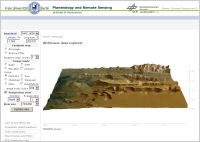
Screenshot of the HRSCview tool at FU Berlin |
The new DTMs and ortho-images are Level-4 data products of the HRSC and the work for deriving them from the lower level HRSC data is split between DLR and FU Berlin.
The newly released DTMs are based on HRSC data from the first six months of the Mars Express mission and together cover about 12% of the Martian surface. The ortho-images have been made using the information from the DTMs. They are corrected for viewing angle and show the surface as viewed from directly overhead for each point in the image (a map projected ortho-rectified nadir image). The ortho-images are therefore only available for those regions covered by the DTMs.
Access to the HRSC data products
The Level-4 HRSC data products are publicly available and can be accessed at three different sites (see also the related links in the right-hand navigation):
| ESA Planetary Science Archive (PSA) http://www.rssd.esa.int/index.php?project=PSA | |
| HRSCview - joint site by FU Berlin/DLR http://hrscview.fu-berlin.de/ | |
| NASA Planetary Data Science (PDS) http://pds-geosciences.wustl.edu/missions/mars_express/ |
As of 5 february the ESA PSA contains the Level-4 data products of the first six months of the Mars Express mission. The HRSCview archive contains also more recent DTMs from later orbits which will be integrated later in batches in the ESA and NASA planetary archives.
