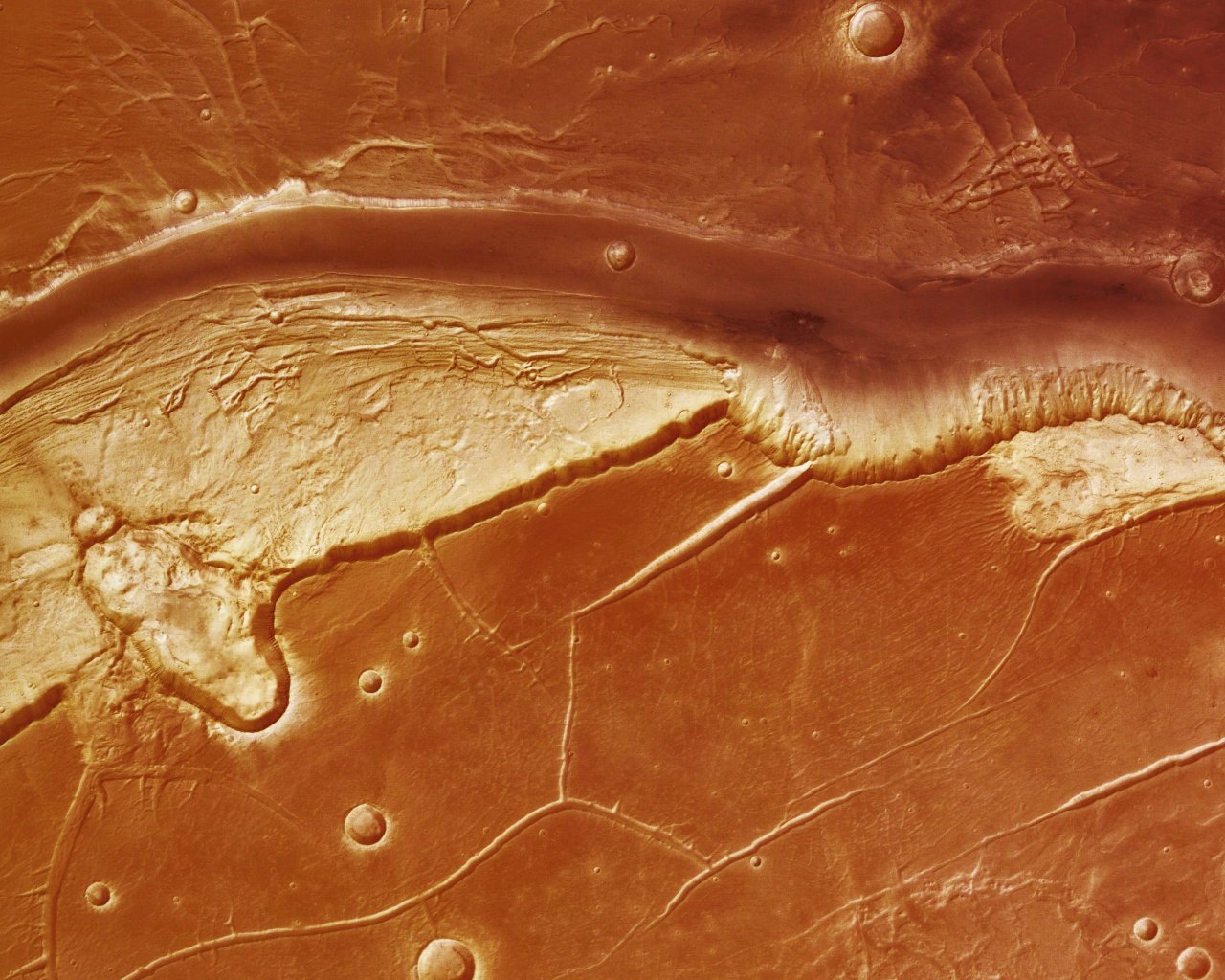
North Branch of Kasei Valles

Date: 31 August 2006
Satellite: Mars Express
Depicts: Nothern branch of Kasei Valles on Mars
Copyright: ESA/DLR/FU Berlin, CC BY-SA IGO 3.0
This image was taken by the High Resolution Stereo Camera (HRSC) on board Mars Express, during orbit 1429 at a ground resolution of approximately 29 metres per pixel. It shows the northern branch of Kasei Valles, one of the biggest outflow channel systems on Mars. North is up.
The Kasei Valles region lies approximately between latitude 21° and 28° North at 292.5° East longitude. It connects Echus Chasma, an elongated depression which lies to the south, with the plain Chryse Planitia which lies to the east.
Kasei Valles has a width of roughly 500 kilometres and, if Echus Chasma is included, extends for approximately 2500 kilometres. As one of the biggest outflow channel systems on Mars, Kasei Valles was probably formed by gigantic flood events and later additionally shaped by glacial activity.
The two main branches (the north branch in this picture, and the south branch under the related images) of Kasei Valles extend approximately south-west to north-east and exhibit a depth of 2900 metres. Between the two branches lies Sacra Mensa, a flat-topped prominence with cliff-like edges.
In this image part of the plain Sacra Mensa can be seen below the northern branch of Kasei Valles. An oval structure at the western edge of the scene is interpreted to be a crater caused by an oblique meteorite impact.
The colour scene was derived from three HRSC-colour channels. Image resolution has been decreased for use on the internet.
This work is licensed under a Creative Commons Attribution-ShareAlike 3.0 IGO License. 
