Topography of Mars
 Copyright: Public Domain
Show in archive: true
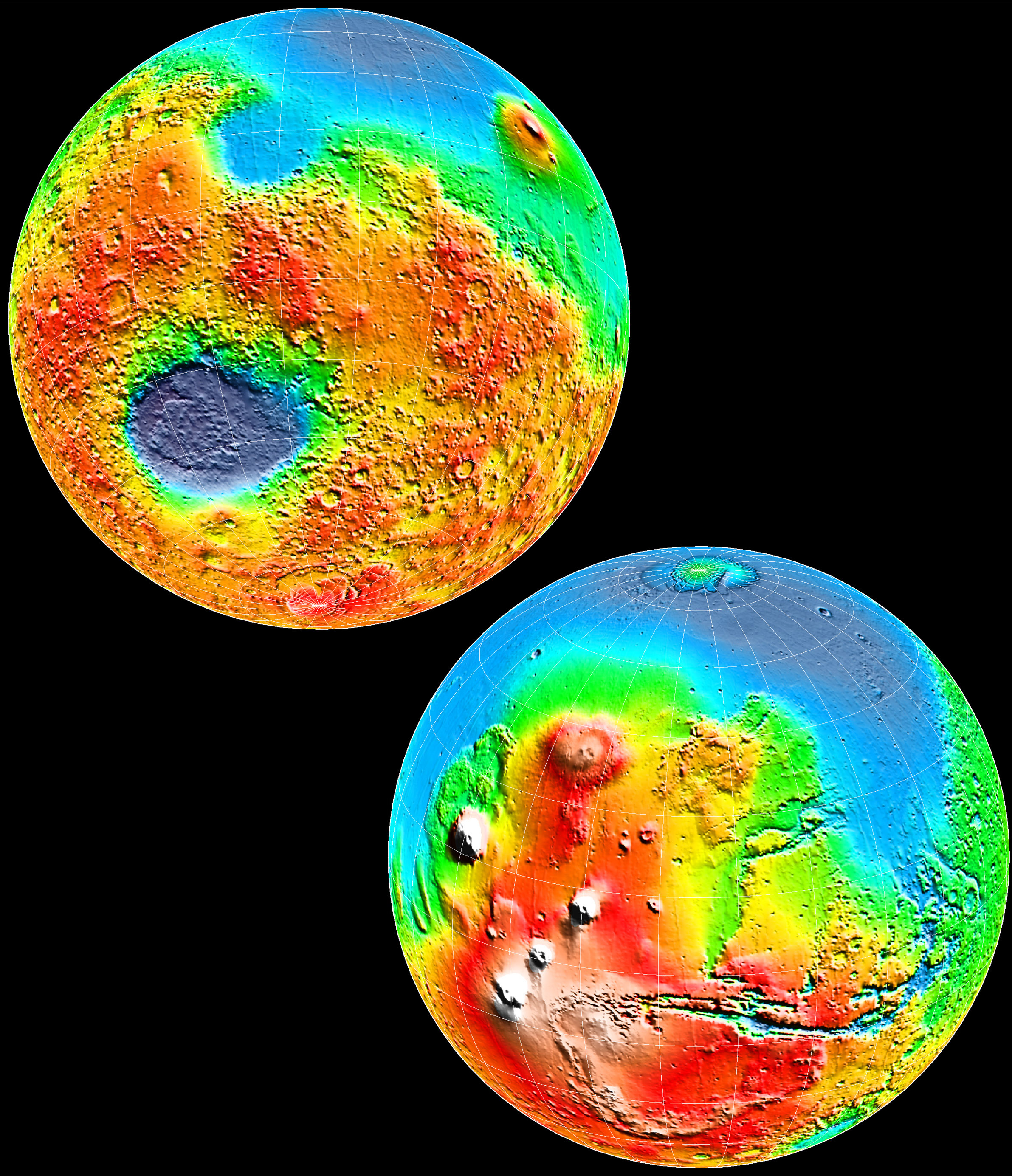
This image shows the topography of two of the hemispheres of Mars. The image was seen on the
cover of Science magazine in May of 1999. The most prominant features in this image are: 1) The
massive Hellas impact basin (upper-left) in the Southern Hemisphere which is nearly six miles
(nine kilometers) deep and 1,300 miles (2,100 kilometers) across. The basin is surrounded by a ring
of material that rises 1.25 miles (about two kilometers) above the surroundings and stretches
out to 2,500 miles (4,000 kilometers) from the basin center. 2) The lower-right image shows the
Tharsis province that contains Tharsis Montes (Ascraeus, Pavonis, and Arsia), and the Valles Marineris
canyon system and related outflow
channels.
Copyright: Public Domain
Show in archive: true
This image shows the topography of two of the hemispheres of Mars. The image was seen on the
cover of Science magazine in May of 1999. The most prominant features in this image are: 1) The
massive Hellas impact basin (upper-left) in the Southern Hemisphere which is nearly six miles
(nine kilometers) deep and 1,300 miles (2,100 kilometers) across. The basin is surrounded by a ring
of material that rises 1.25 miles (about two kilometers) above the surroundings and stretches
out to 2,500 miles (4,000 kilometers) from the basin center. 2) The lower-right image shows the
Tharsis province that contains Tharsis Montes (Ascraeus, Pavonis, and Arsia), and the Valles Marineris
canyon system and related outflow
channels.
Last Update: 1 September 2019