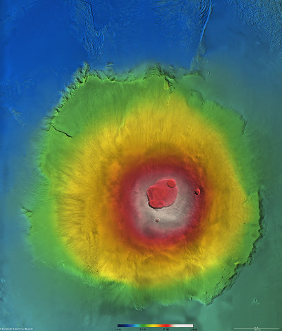
Olympus Mons topography
Date: 26 April 2012
Satellite: Mars Express
Depicts: Olympus Mons topography
Copyright: ESA/DLR/FU Berlin, CC BY-SA IGO 3.0
Olympus Mons colour-coded according to height from white (highest) to blue (lowest), based on images captured by the High Resolution Stereo Camera (HRSC) on board ESA's Mars Express. New data (see M. Beuthe et al., 2012) find that Olympus Mons is built on a rigid lithosphere whereas the nearby Tharsis Montes partially sank into a less rigid lithosphere, suggesting that there were large spatial variations in the heat flux from the mantle at the time of their formation.
This work is licensed under a Creative Commons Attribution-ShareAlike 3.0 IGO License. 
Last Update: 1 September 2019