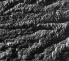
Enceladus Fly-by - 31 October 2008
29 October 2008
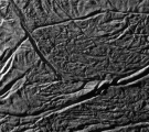
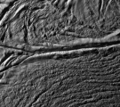
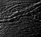
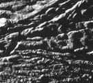
Just over three weeks after the previous fly-by of Enceladus, Cassini will again fly by this Saturnian moon, passing at an altitude of 197 kilometres. Cassini will approach Enceladus on a fast, inclined trajectory over the northern hemisphere and will depart over the southern hemisphere. The closest approach occurs on 31 October at 17:14:51 UT over latitude 28° S and longitude 97° W.The Optical Remote Sensing (ORS) instruments are at the focus of the science operations during this fly-by. The Imaging Science Subsystem camera will execute a sophisticated series of images starting just 2 minutes after closest-approach, obtaining images of the south polar "tiger stripes" at resolutions as high as 8.4 m/pixel. Enceladus will be in eclipse (in Saturn's shadow) for about 2.5 hours starting about 50 minutes after closest-approach.
This encounter will occur 3 days prior to the T46 Titan fly-by (of 3 November), on the inbound leg of Cassini's orbit number 91.
Science Activities
- Imaging Science Subsystem (ISS)
ISS will image the south polar terrain at up to 8.4 meter-scale resolution. ISS will execute a "skeet shoot" series of images to carefully balance light and smear during the closest approach of this fast fly-by. Results will be compared with complementary coverage from the 080EN fly-by to study both active and inactive regions. - Composite Infrared Spectrometer (CIRS)
CIRS will make observations of the south polar temperatures during solar eclipse to determine the heat capacity and textural properties of the regolith. These maps will complement data obtained in previous fly-bys. During this fly-by, while in sunlight, CIRS will focus on the Damascus and Cairo sulci. - Visual and Infrared Mapping Spectrometer (VIMS)
VIMS will perform compositional mapping and will look for confirmation of weak spectral features such as those due to organics, CO2, ammonia, and other compounds. VIMS will search for hotspots with temperatures >140K. - Ultraviolet Imaging Spectrograph (UVIS)
UVIS will obtain spectral images of Enceladus in the EUV (500-1100 Å) and FUV (1100-1900 Å) to map the surface composition, including water ice abundances and grain sizes, and will search for volatiles in the vicinity of Enceladus.
Table of events
18 October 2008
| Time UTC | Time wrt EN-91 |
Activity |
| 20:21:00 | -12d21h | Start of sequence S45 which contains Enceladus-91 |
30 October 2008
| Time UTC | Time wrt EN-91 |
Activity |
| 19:37:00 | -21h37m | Start of the SOST segment which contains 091EN. |
| 20:22:00 | -20h52m | pre-Enceladus science, observations of Saturn aurorae |
31 October 2008
| Time UTC | Time wrt EN-91 |
Activity |
| 00:40:00 | -16h34m | Inbound Enceladus plume observations (distant). 3.6 hour medium-phase angle observation of Enceladus (inbound over northern hemisphere). ISS prime |
| 05:05:00 | -12h09m | Downlink of radio science gravity measurements (Madrid 70m) |
| 08:20:00 | -08h54m | Deadtime, 15 minutes long. Used to accommodate changes in flyby time |
| 08:35:51 | -08h39m | Inbound ORS observations. UVIS prime - distant neutral gas distribution measurements |
| 12:14:51 | -05h00m | Inbound ORS observations. VIMS prime - northern hemisphere compositional measurements |
| 13:14:51 | -04h00m | Inbound ORS observations. CIRS prime - series of stares, scans of northern hemisphere |
| 16:04:51 | -01h10m | Inbound ORS observations. VIMS prime - northern hemisphere compositional measurements |
| 16:34:51 | -00h40m | Inbound ORS observations. ISS prime - turn spacecraft to capture south pole and execute "skeet shoot" and mosaic |
| 17:14:51 | +00h00m | Enceladus-91 Flyby Closest Approach Time. Altitude =196.9 km, speed = 17.7 kms-1, mid phase inbound, 113.3° phase at closest approach, mid phase outbound |
| 17:44:51 | +00h30m | Outbound ORS observations. Outbound UVIS south pole scan |
| 18:04:51 | +00h50m | Outbound ORS observations. CIRS eclipse measurements of south pole |
| 21:14:51 | +04h00m | Outbound ORS observations. VIMS prime - compositional mapping of southern hemisphere |
| 22:14:51 | +05h00m | Outbound ORS observations. UVIS prime - distant neutral gas distribution measurements |
1 November 2008
| Time UTC | Time wrt EN-91 |
Activity |
| 00:14:51 | +07h00m | Deadtime, 15 minutes long. Used to accommodate changes in flyby time |
| 03:20:00 | +10h06m | Downlink of radio science gravity measurements (Madrid 70m) |
| 06:15:00 | +13h01m | Outbound ORS observations. UVIS prime - distant neutral gas distribution measurements |
| 10:22:00 | +17h08m | Downlink, 9 hr (Goldstone 70m) |
Observation Results
Cassini Instrument: Imaging Science Subsystem (ISS)
* See the related links for more details on the skeet shoot sequence.

