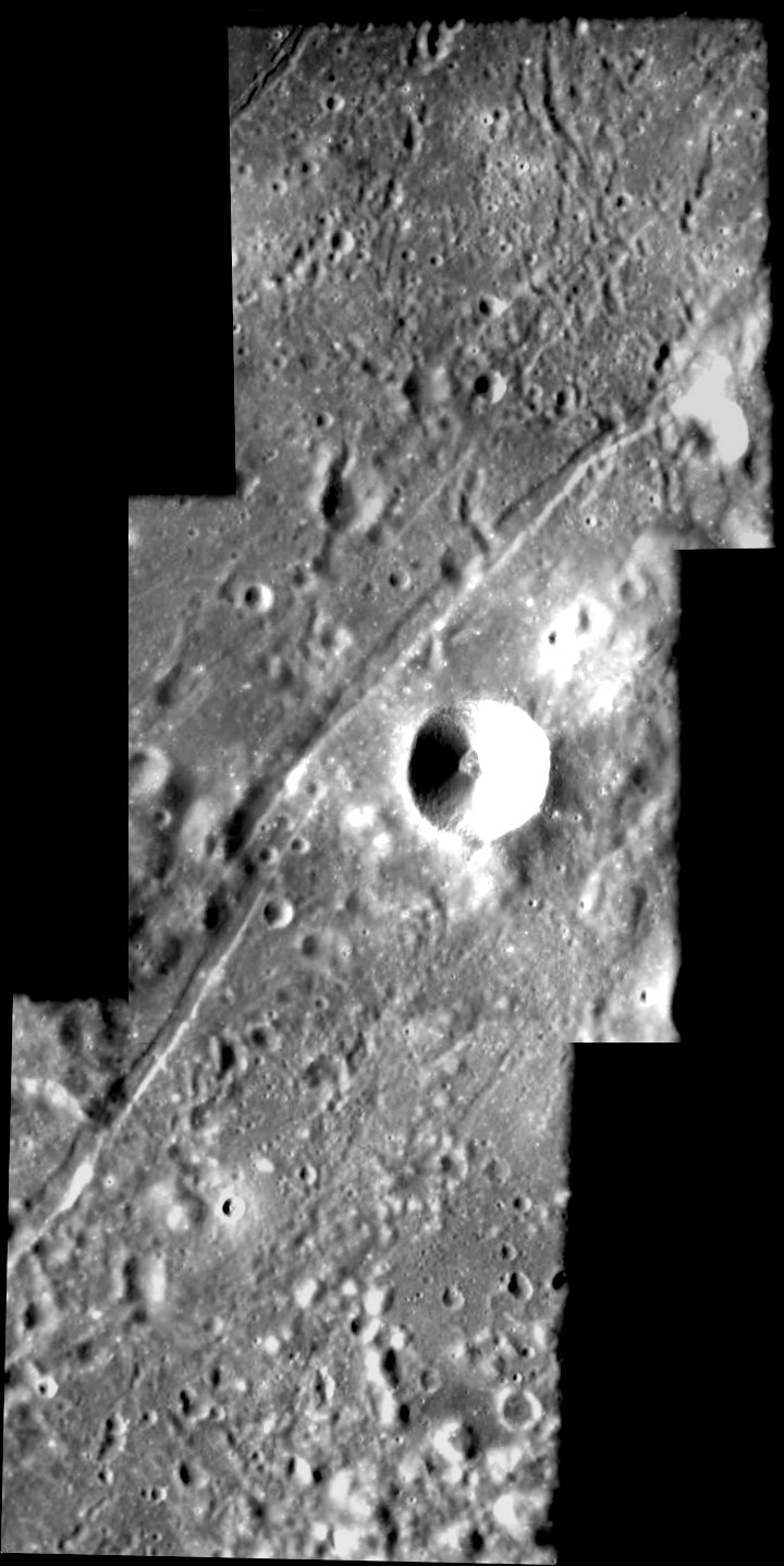
Crater Mersenius C

Date: 31 July 2006
Satellite: SMART-1
Copyright: ESA/SPACE-X (Space Exploration Institute)
This mosaic of three images, taken by the advanced Moon Imaging Experiment (AMIE) on board SMART-1, shows the crater Mersenius C. The images are located at a longitude of 45.7° West, and at latitudes of 18.1° South, 19.7° South and 21.3° South, respectively. AMIE obtained this sequence on 13 January 2006, from a distance of 1195, 1172, 1149 kilometres from the surface, respectively. The ground resolution ranges from 104 to 108 metres per pixel. North is up.
Crater Mersenius C is positioned in the highland area between Mare Humorum and the Oceanus Procellarum. The crater has a diameter of 14 kilometres and is best visible for ground-based observers 4 days after first quarter Moon. The crater is surrounded by a system of grabens, which are fractures that form when the lunar surface sinks as a result of faults. They can be seen running diagonally across this image.
The larger crater Mersenius is 84 kilometres in diameter and lies ~225 km southwest of Mersenius C. The crater is named in honour of Marin Mersenne, a French mathematician, philosopher and physicist (1588-1648).
| Parameter | Top image | Centre Image | Bottom Image |
| Date | 13 January 2006 | 13 January 2006 | 13 January 2006 |
| Distance | 1195 km | 1172 km | 1149 km |
| Longitude | 45.7° W | 45.7° W | 45.7° W |
| Latitude | 18.1° S | 19.7° S | 21.3° S |
| Resolution | 108 m/pixel | 106 m/pixel | 104 m/pixel |