VIRTIS view of the Earth (VIS-1)

Date: 25 November 2009
Satellite: Rosetta
Depicts: VIRTIS spectral image of the Earth
Copyright: INAF-IFSI/INAF-IASF/ASI
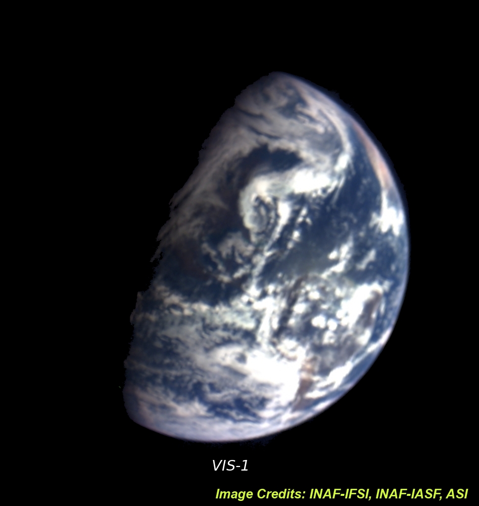
VIRTIS was one of the instruments aboard Rosetta that were active during the spacecraft's third Earth swingby on 13 November 2009. This image was taken by VIRTIS several hours after closest approach, when the spacecraft was at about 230 000 km from the Earth's surface and receding again from the planet.
One of the two channels of the VIRTIS instrument is the Mapper (VIRTIS-M), a hyperspectral imager that collects image data simultaneously in 864 narrow, adjacent spectral bands (colours). The observations in different sets of narrow bands can be combined to generate different views of the Earth.
This image (called "VIS-1" in the related image "VIRTIS spectral images of the Earth", linked from the right-hand menu) has been taken over the American continents on 13 November at 14:00 UT in the visible-near infrared spectral range (350-1000nm). It has a spatial resolution of about 50 km. The selected colours are those usually adopted in RGB imaging (with red, green and blue at 0.7 µm, 0.55 µm and 0.44 µm respectively). The clouds cover almost all the Earth, with only few areas of ground in North and South America visible. On the top-right the westernmost coast of Africa can also be seen.
